Maps of Hanmer Lake
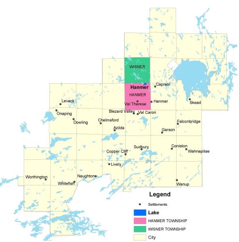
Township Map
Hanmer Lake is located in Hanmer township.
UTM Coordinates:
Easting 502090, Northing 5173089
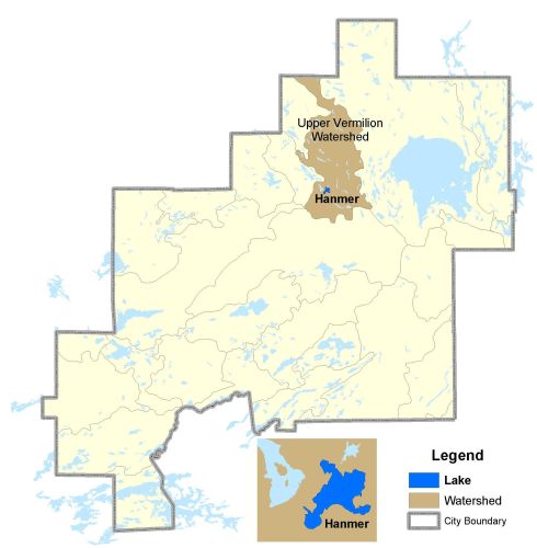
Watershed Map
Hanmer Lake is located in the Upper Vermilion Watershed. For more information on the watershed, and on the data obtained for this lake, please click on the following link: Watershed Map
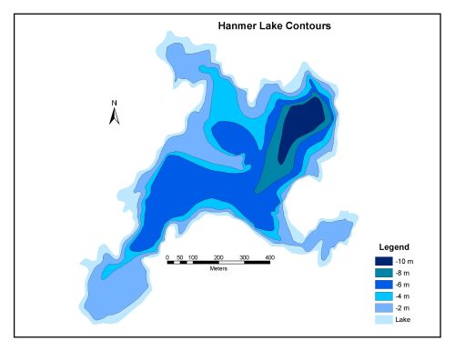
Bathymetric Map
Hanmer Lake is 54.4 hectares in size with a shoreline perimeter of 5.9 kilometers. The maximum depth of Hanmer Lake is 10 meters.