Maps of Whitewater Lake
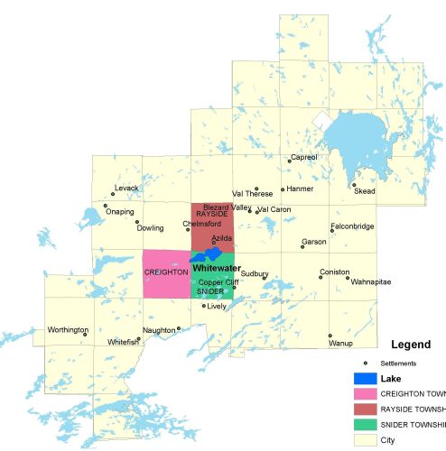
Township Map
Whitewater Lake is located in Rayside, Snider, and Creighton townships and is situated about 20 minutes from downtown Sudbury, in the town of Azilda.
UTM Coordinates:
Easting 488958, Northing 5153282
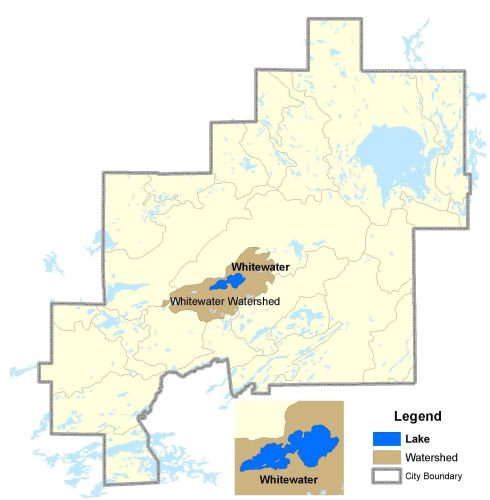
Watershed Map
Whitewater Lake is located in the Whitewater Watershed. For more information on the watershed, and on the data obtained for this lake, please click on the following link: Watershed Map
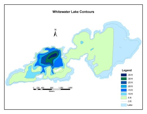
Bathymetric Map
Whitewater Lake is 949.1 hectares in size with a shoreline perimeter of 29.5 kilometers. The maximum depth of Whitewater Lake is 11 meters. (35 feet).
Whitewater Lake is 7 km long and varies in width from 0.4 km to 3 km. Surface area of the lake is about 9 km2 and the shoreline, excluding islands, runs for 25 km. There are five streams entering the lake from the south and three through the built up area on the northern shore. The lake drains from the western end to Levery Creek, which joins the Vermilion River. Since 1976 a dam on Levery Creek has controlled the water level. The lake is divided into east and west by a strait. The eastern section is shallow (3 m), and the western section is deeper (greater than 10 m).