Maps of Vermilion Lake
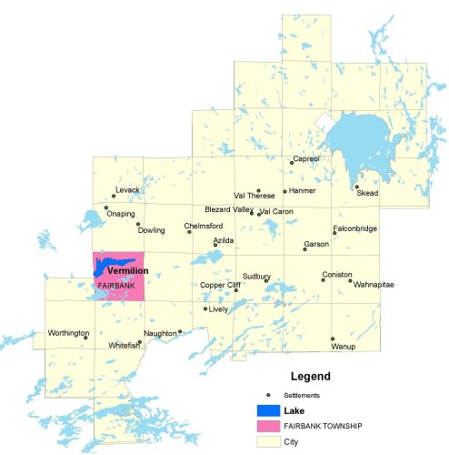
Township Map
Vermilion Lake is located in Fairbank Township, approximately 33 kilometres west of downtown Sudbury.
UTM Coordinates:
Easting 467532, Northing 5151144
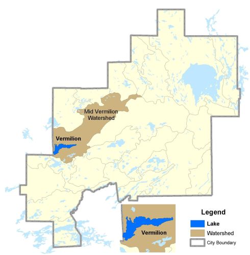
Watershed Map
Vermilion Lake is located in the Mid-Vermilion Watershed. The drainage basins' topography is characterized by rugged Precambrian terrain, which covers an area of about 2850 km2. 778 km2 are in the Onaping River watershed below the influence of Bannerman Creek, while the remainder is in the Vermilion River watershed.
For more information on the watershed, and on the data obtained for this lake, please click on the following link: Watershed Map
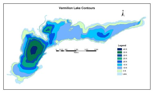
Bathymetric Map
Vermilion Lake is 1126.6 hectares in size with a shoreline perimeter of 32.4 kilometers. The maximum depth of Vermilion Lake is 12 meters (40 feet). The level and outflow volume of Vermilion Lake are controlled by the Stobie dam, which is located at the east end outlet.