Maps of Ramsey Lake
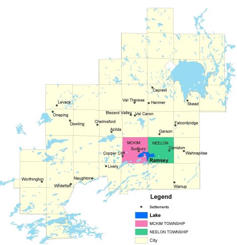
Township Map
Ramsey Lake is located in the McKim and Neelon townships.
UTM Coordinates:
Easting 503620 Northing 5146649
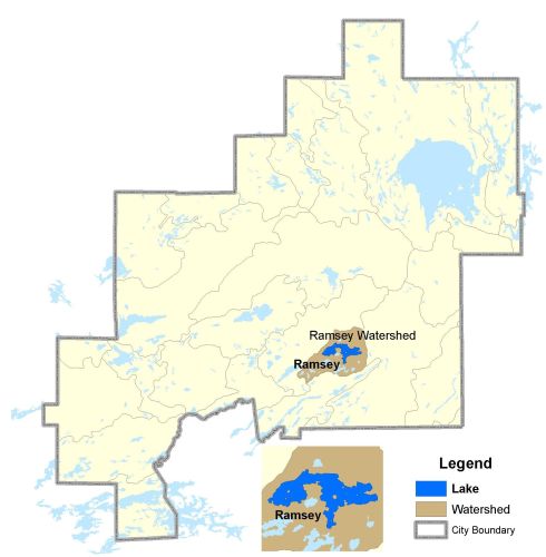
Watershed Map
Ramsey Lake is located in the Ramsey Watershed. The lake receives drainage from Minnow Lake and several other creeks on the north shore and Laurentian Lake on the south shore. Bethel Lake also occasionally flows into Ramsey Lake during high water periods. Ramsey drains into Lily Creek that connects Robinson and Kelley Lakes, eventually draining into Georgian Bay by way of the Spanish River. Ramsey Lake is used as a source of water for the city and for numerous recreational activities including angling, swimming, sailing, boating, and water skiing.
For more information on the watershed, and on the data obtained for this lake, please click on the following link: Watershed Map
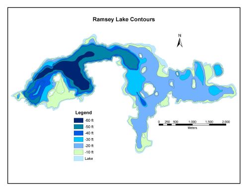
Bathymetric Map
Ramsey Lake is 792.2 hectares in size with a shoreline perimeter of 34.0 kilometers. The maximum depth of Ramsey Lake is 20.5 meters (60 feet).