Maps of Lake Wanapitei
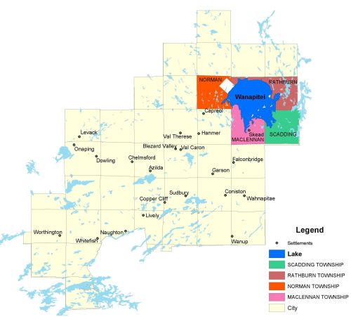
Township Map
Lake Wanapitei is located in Norman, Rathburn, Scadding, and Maclennan townships, 34 kilometres northeast of Sudbury.
UTM Coordinates:
Easting 519438, Northing 5174503
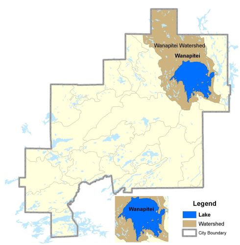
Watershed Map
Lake Wanapitei is located in the Wanapitei Watershed.
For more information on the watershed, and on the data obtained for this lake, please click on the following link: Watershed Map
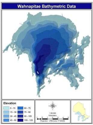
Bathymetric Map
Lake Wanapitei is 13,256.80 hectares in size with a shoreline perimeter of 160.40 kilometers. The maximum depth of the lake is 142 meters (466 feet).