Maps of Raft Lake
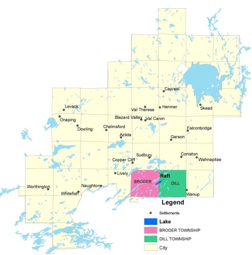
Township Map
Raft Lake is located in Broder and Dill townships.
UTM Coordinates:
Easting 504384, Northing 5139804
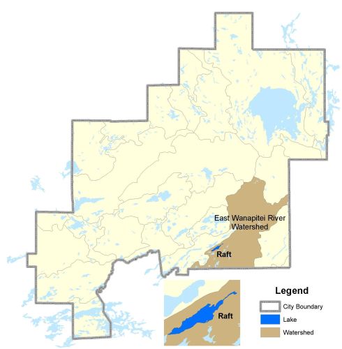
Watershed Map
Raft Lake is located in the East Wanapitei River Watershed. For more information on the watershed, and on the data obtained for this lake, please click on the following link: Watershed Map
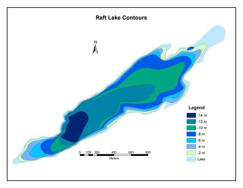
Bathymetric Map
Raft Lake is 109.6 hectares in size with a shoreline perimeter of 9.3 kilometers. The maximum depth of Raft Lake is 14 metres.